Homeowners want more answers after learning of new state firefighting effort that could affect 80,000 Oregon properties
Vince Webb, owner of Orgro Business Park on Foothill Boulevard in Grants Pass, is wondering why his paved and recorded commercial property is in a high-risk wildfire zone on a new fire risk map in the whole state [Jamie Lusch / Mail Tribune]
After more than 1,200 people logged into a Zoom meeting Wednesday night in southern Oregon to learn more about the state’s new wildfire risk map, one of the sponsors of the legislation that led to map creation said the process might need to slow down.
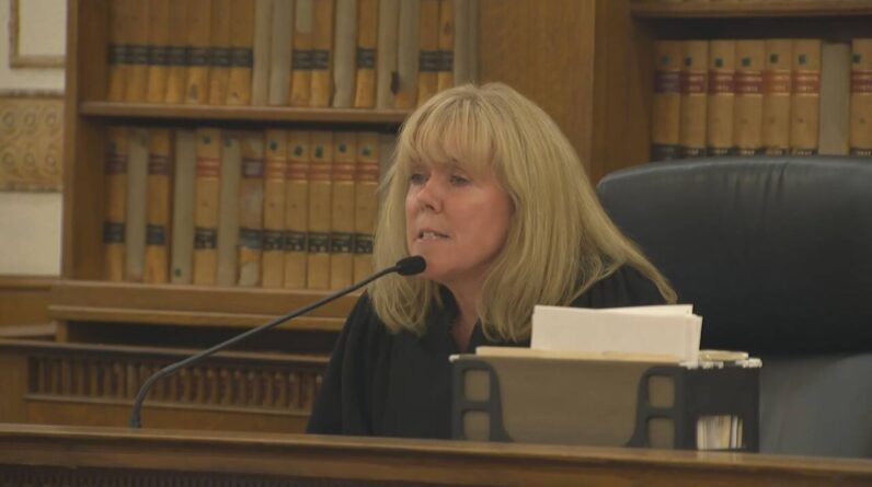
“I think this map needs work,” state Sen. Jeff Golden, D-Ashland, said in an interview Thursday morning, referring to a state map created by Oregon State University and the Oregon Department of Forestry which places all properties in Oregon in a fire risk category.
The map and Senate Bill 762, the legislation that spawned it, are part of a comprehensive effort by the Legislature to deal with the worsening wildfires that have devastated communities in Oregon in recent years.
Individuals who own property in high or extreme fire hazard areas within an urban-forest interface zone may face a number of new requirements, such as home hardening building codes that still are being drafted, new defensible space requirements yet to be revealed, and quite possibly higher. insurance rates or even cancellation of insurance.
As many as 120,000 tax lots, about 8.8 percent of Oregon properties, are within the highest-risk areas, OSU researcher Chris Dunn said at the Zoom meeting.
“I think there are gaps in this map between what the science tells us and what you see with your own eyes when you walk,” Golden said. “And we have to interact more with the insurance sector. We already knew we had to do it, but we have to make it a higher priority.”
Discussion of how property insurance could be affected by the new risk map was a recurring theme during a question-and-answer portion of Wednesday’s meeting.
Vince Webb, who lives on an 80-acre property outside Grants Pass that the new map places in the extreme risk category, said his homeowner’s insurance was canceled three weeks ago when his policy was renewed . The reason given by his insurance company was the designation of the property on the new fire map, he said during the Zoom meeting.
It was surprising, Webb said, because until then he hadn’t heard about the new map, which was made public last month. His first look came after he and other property owners across the state who are affected by the new risk categories received notices last week informing them of the map.
Webb said he shopped around and checked with as many as a dozen other insurance companies, some of which wouldn’t offer quotes because of the fire risk map. Finally, he bought a new policy, the cheapest one he could find, which cost $2,000 more per year than his previous policy.
“This is something that could happen to anyone with a high or extreme flag on the map,” Webb said in an interview Thursday.
Nothing in SB 762 addresses the possibility of insurance cancellations or rate increases, even for people who follow all the rules to harden their properties and create a defensible space, said Brian Fordham, Oregon’s director of insurance product regulation and compliance, during the Zoom session.
“They’re trying to gloss over it, but there’s a 900-pound gorilla in the room, and it’s the insurance issue,” Webb said Thursday. “For whatever reason, nobody’s talking about it. There’s a lot of ripples from it, and it’s already affected me.”
In addition to the property where he lives, Webb owns Orgro Business Park, at 2795 Foothill Blvd., in Grants Pass. Located off Interstate 5, the property is paved and graded with no grass or brush, covered with metal buildings and fenced, but appears on the new map in a high risk area.
“My commercial property insurance policy is up for renewal in October, and my insurance broker has told me that the policy is under review,” he said.
Golden said Thursday that no one should have to cancel their insurance if they work to protect their property from fire.
“We need to make sure that people who are doing what they can to reduce their fire risk can get insurance,” Golden said.
He also said, “we have to look closely at the timelines,” referring to a schedule showing new fire-hardening building codes and defensible space requirements that are slated to go into effect in early 2023.
Several people at the meeting were upset that their properties are in an extreme fire risk zone, despite being part of Firewise communities, or that they have taken steps to reduce their fire risk.
They wanted to know if ODF or others visit the site to view their properties if they appeal their listings to the maps.
State officials were unclear if site visits would be conducted. For one thing, the ODF staff qualified to judge a property’s fire risk are halfway through the fire season, and with 80,000 or more properties affected, that would be a tall order.
“There should be people coming into the ground,” Golden said. “If I owned a property, I’d like a visit.”
For that to happen, the Legislature will have to look to add money to ODF budgets to fund the field trips, he said.
Others at the meeting said they felt homeowners were being asked to bear most of the costs caused by SB 762, but had little to do with the causes of fires, such as arson, in the case of the Almeda fire and several fires. intentionally established already this year, and poor forest management practices by the Bureau of Land Management and the US Forest Service.
For example, many property owners who will need to create defensible space around their homes are surrounded by federal lands that cause the high-risk situation, but federal land managers are not required to make any changes or create firewalls between their lands and private properties on the maps.
“I really understand how upset people are,” Golden stressed. “I’m not surprised by their distress. But what we have to keep in mind is that our communities are burning now. A large part of this valley could burn.
“That means launching early and course-correcting as we go. … Without bold action, the Almeda fire, and likely worse, is Oregon’s future.
“We are trying to defend our state from destruction,” he added during the Zoom meeting. “It’s right here. We don’t need more demonstrations.”
For a recording of Wednesday’s Zoom meeting, see
Contact Mail Tribune Editor David Smigelski at dsmigelski@rosebudmedia.com or 541-776-4484.
[ad_2]
Source link


