Grant’s Friday Night Forecast
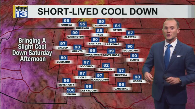
Temperatures will be slightly cooler Saturday afternoon. Warmer temperatures return next week.
More parts of New Mexico will see a break from the triple-digit heat Saturday thanks to a cold front moving through the state today. It will be a close call for parts of southern New Mexico like Roswell and Las Cruces, where high temperatures could still reach 100°. There will also be another chance for scattered thunderstorms in the afternoon, including thunderstorms in metro Albuquerque. However, the risk of severe weather and flash flooding is lower.
Temperatures begin a warming trend again Sunday as high pressure begins to migrate into the state. This will also work to put a lid on the storms, keeping the best chance for afternoon showers and storms over the higher elevations and mountains into the middle of next week. The center of high pressure will be over New Mexico starting Monday, bringing a stretch of dangerously warm temperatures again.
A stream of monsoonal moisture will attempt to reach New Mexico by Thursday of next week, bringing better rain chances to areas along and west of the Rio Grande Valley and northern New Mexico. This will also help cool the temperatures down a few degrees.
[ad_2]
Source link


